
Into the highlands of the Andean Northwest
Although the travel can be challenging, we soon realized that the highlands of Argentina’s Andean Puna are definitely worth visiting. Of course, we didn’t begin to realize this until about 24 hours after we crossed the border at Paso Sico… after we had changed our flat tire in the middle of the desert and continued along the rough gravel road toward the city of Salta.

Our journey through Northwestern Argentina
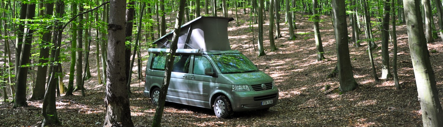
After countless hours we finally arrived at the dusty pueblo of Olacapato. As we looked around the village with its unpaved roads and abandoned buildings of adobe brick, it appeared to be a ghost town, perhaps one of the deserted mining communities that we had seen in Chile. We later discovered that the altitude here is 4,080 m (13,386 ft), making it one of Argentina’s highest communities. Night was fast approaching; it was windy and cold, so we searched for a protected camping spot. While we were there we met some of the inhabitants, who were extremely friendly and kind.

Camping next to the village church, Olacapato, Argentina

Olacapato, Argentina
The provinces in the Northwest are among the poorest in Argentina, though rich in spectacular scenery, especially the amazing rock formations and pre-Colombian ruins. Along the unpaved road to Salta we climbed to 15,000 ft and spotted rhea, llamas and vicuñas, the local wildlife. Towering cordón cacti are everywhere.

Darwin’s Rhea on the road to San Antonio de los Cobres, Argentina

Llamas on the road to San Antonio de los Cobres, Argentina

Alto Chorillo, Argentina 4560 m (15,000 ft)

Overlooking the road to San Antonio de los Cobres, Alto Chorillo, Argentina

Cardón cactus on the road to Salta, Argentina
The first major town we came to was San Antonio de los Cobres, a typical highland settlement and former mining community in the Puna. Though there is little to see here it gives you the feel for Andean life. Further south are the ruins of the indigenous community who once lived at Santa Rosa de Tastil, dating from 1,000 to 1450. Above us we could see an old bridge where the tourist train El Tren a las Nubes (Train to the Clouds) passes.

San Antonio de los Cobres, Argentina

Museo Regional, Santa Rosa de Tastil. Argentina

Village of Santa Rosa de Tastil, Argentina

At the ruins, Santa Rosa de Tastil, Argentina

At the ruins, Santa Rosa de Tastil, Argentina

At the ruins, Santa Rosa de Tastil, Argentina

Bridge for El Tren de las Nubes near Rosario de Lerma, Argentina
The last segment of the road to Salta is paved and the city is truly beautiful, living up to its nickname, “La Linda.” It is one of the oldest cities in Argentina and has preserved much of its colonial architecture. We loved its leafy plazas, and live musica folklórica (folk music). It is also well known for its museums, two of which we can recommend highly. Museo de Arqueologia de Alta Montańa (Museum of High Mountain Archaeology) focuses on Incan culture, particularly the child sacrifices left on some of the Andes’ most imposing peaks. They have 5 mummies, two of which are rotated each month… chilling though fascinating. Pajcha – Museo de Arte Etnico Americano Is also a must-see if you’re interested in indigenous art and culture.

Catedral Basílica de Salta, Salta, Argentina

Plaza 9 de Julio, Salta, Argentina

Buildings facing Plaza 9 de Julio, Salta, Argentina

Folk singer at a stoplight, Salta, Argentina

Pajcha Museo de Arte Etnico Americano, Salta, Argentina
Valles Calchaquíes is south of Salta and is reached through an off-the-beaten-track but picturesque unpaved road. It took us through rugged landscapes and remote adobe villages, some of them quite remote. We climbed a narrow winding road with cacti and multicolored mountains, stopping at Piedra de Molino at an altitude of 3,457m (11,342 ft). The biggest “city” here is Cachi, actually a village surrounded by stunning scenery. We stopped to meander the cobblestone streets, adobe houses and tranquil plaza. Next was laid-back Molinos, with beautiful colonial buildings and a 17th century church that features a ceiling of cardón cactus.

Piedra del Molino, Valles Calchaquíes, Argentina 3,457m (11,342 ft)

Piedra del Molino, Valles Calchaquíes, Argentina 3,457m (11,342 ft)

On the road to Cachi, Argentina

On the road to Cachi, Argentina

On the road, Valles Calchaquíes, Argentina

On the road, Valles Calchaquíes, Argentina

On the road, Valles Calchaquíes, Argentina

City center, Cachi, Argentina

Iglesia San José de Cachi, Cachi, Argentina

Iglesia San José de Cachi, Cachi, Argentina

Plaza Central, Cachi, Argentina

Plaza Central, Cachi, Argentina

View of Cachi, Argentina

Iglesia San Pedro Nolasco, Molinos, Argentina 17th c

Iglesia San Pedro Nolasco, Molinos, Argentina 17th c

Cardón cactus wood ceiling, Iglesia San Pedro Nolasco, Molinos, Argentina 17th c
The rock formations became even more harsh and dramatic as we approached the city of Cafayate. We camped there for three nights, explored the city and sampled humitas, tamales with cheese and corn. Nearby is the magnificent Quebrada de las Conchas, a canyon that has been carved out by the Rio de las Conchas, It is a wild landscape of richly colored sandstone and unearthly rock formations. The scenery reminded us of southern Utah and the Grand Canyon. Unfortunately there wasn’t much sun that day and, in fact, we had to leave early because of rain…

On the road, Valles Calchaquíes, Argentina

Interesting building in Cafayate, Argentina

Mural in Cafayate, Argentina

“Los Colorados,” rock formations at Cuebrada de las Conchas, Argentina

“Los Castillos,” rock formations at Cuebrada de las Conchas, Argentina

“Las Ventanas,” rock formations at Cuebrada de las Conchas, Argentina

“El Sapo (The Toad),” rock formations at Cuebrada de las Conchas, Argentina

“Quebrada a Paranilla,” rock formations at Cuebrada de las Conchas, Argentina
South of Cafayete are the Quilmes Ruins, a complex indigenous urban settlement that dates from about AD 1000. Its inhabitants were the Diaguita people, who survived contact with the Incas but could not outlast the Spanish. The museum there remains closed because of a longstanding dispute between the Diaguita community and the government. We learned more about the geology and indigenous people at the fabulous Museo Pachamama in nearby Amaitcha del Valle.

View of Quilmes Ruins, Valles Calchaquíes, Argentina

Quilmes Ruins, Valles Calchaquíes, Argentina

Quilmes Ruins, Valles Calchaquíes, Argentina

Quilmes Ruins, Valles Calchaquíes, Argentina

Cardón cactus, Quilmes Ruins, Valles Calchaquíes, Argentina

Ceremonial mortar, Quilmes Ruins, Valles Calchaquíes, Argentina

Museo Pachamama, Amaitcha del Valle, Argentina

Gift shop. Museo Pachamama, Amaitcha del Valle, Argentina

Museo Pachamama, Amaitcha del Valle, Argentina

Museo Pachamama, Amaitcha del Valle, Argentina

Museo Pachamama, Amaitcha del Valle, Argentina

Museo Pachamama, Amaitcha del Valle, Argentina

Diorama, Museo Pachamama, Amaitcha del Valle, Argentina

Museo Pachamama, Amaitcha del Valle, Argentina

Museo Pachamama, Amaitcha del Valle, Argentina
We had heard that Tafi del Valle was worth a visit, so we went there next and said goodbye to the beautiful warm weather as we ascended the cold and foggy 3,050 m mountain pass of Abra del Infiernillo (Little Hell Pass). I’m sure the view must have been spectacular but we couldn’t see any of it. Tafi did not attract us and we were put off by all the tourists, tour buses, travel agents and hotels. So we left and camped at Lago Angostura, a pleasant man-made lake on the outskirts of town, then continued on…

A street in Tafi del Valle, Argentina

Wild camping on Lake Angostura, Tafi del Valle, Argentina

Wild camping on Lake Angostura, Tafi del Valle, Argentina
I am thinking you two have traveled roads untraveled before – or However the expression goes! Then you say you were put off by tour buses, etc, when I was thinking “where are other tourists?” Truly amazing rock scenery and at such heights!